How salty is the ocean?
 NASA / GSFC / JPL-Caltech
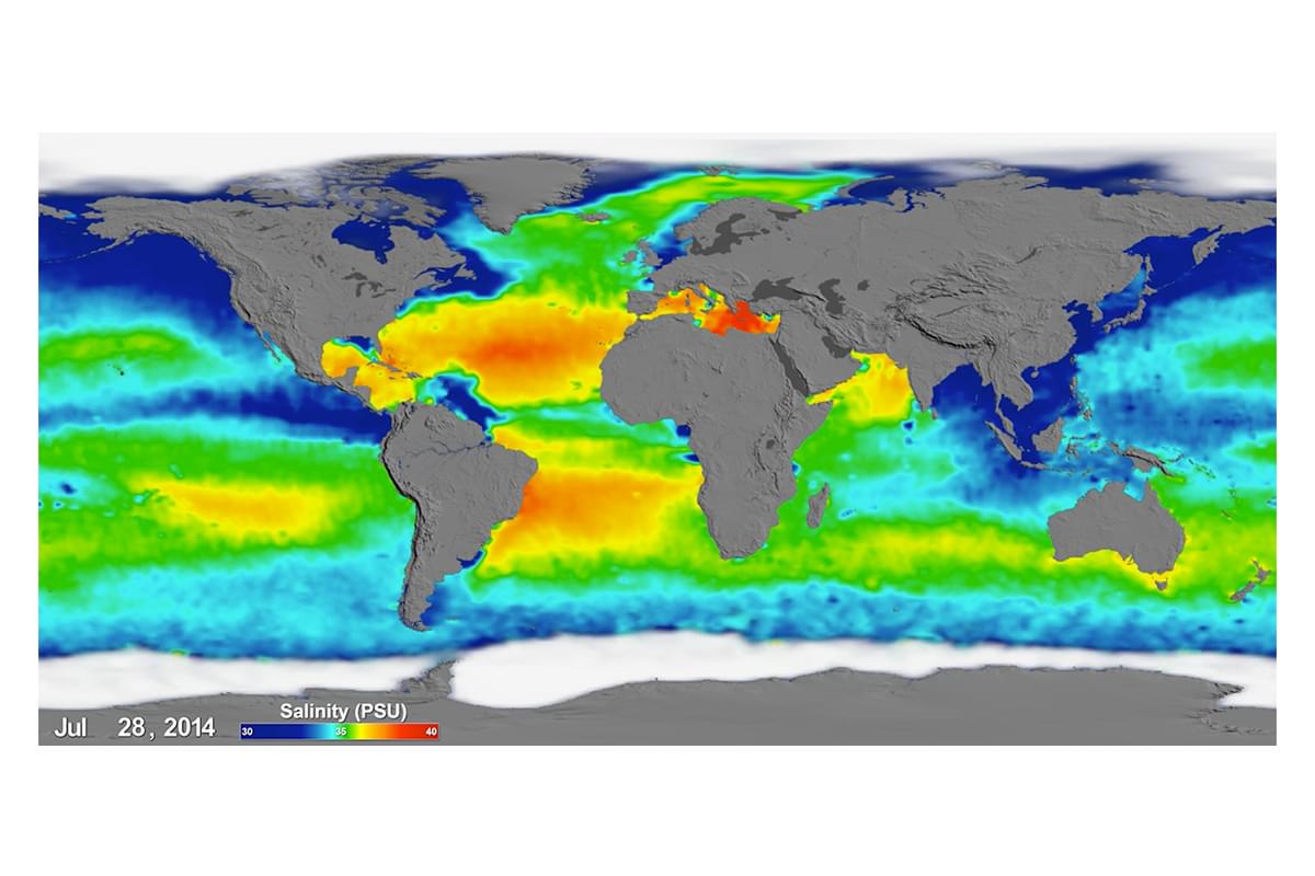
The global map of the salinity, or saltiness, of Earth's ocean surface produced by NASA's new Aquarius instrument reveals a rich tapestry of global salinity patterns. The yellow / red regions of high salinity and the green / blue regions show lower salinity. Can you spot how the freshwater from rivers may affect the saltiness of the sea.
Part of:
AXA Ocean EducationBrought to you by

Geography | Ages 11-14
Frozen Oceans
The Frozen Oceans Geography resources are designed to take 11-14 year-olds on a journey to the Arctic following the expedition team of the Catlin Arctic Survey.
Science | Ages 11-14
Frozen Oceans
The Frozen Oceans Science resources introduce working scientifically concepts and skills to 11-14-year-olds through enquiry-based lessons which replicate work done by field scientists in the Arctic.