Why is thermohaline circulation so important?
 Canuckguy, Robert Simmon, NASA and Robert A. Rohde
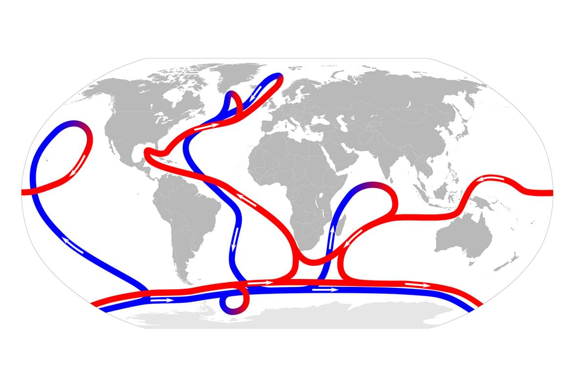
This map shows the pattern of thermohaline circulation, which is responsible for the large-scale exchange of water masses in the ocean. It is called thermohaline circulation as it is driven by different densities of waters falling and rising. These differences in density are caused by the temperature (thermo-) and saltiness (-haline) of the water.
The red arrows show warm surface waters, which then cool and sink in the Arctic, creating a dragging effect that drives this whole ocean conveyor. The entire circulation pattern takes roughly 2,000 years.
Part of:
AXA Ocean EducationBrought to you by

Cross-curricular | Ages 7-11
Frozen Oceans
Based on journeys undertaken by real explorers and scientists, the Frozen Oceans (Primary) education programme is designed to introduce students to what life is like in the High Arctic.
Geography | Ages 11-14
Frozen Oceans
The Frozen Oceans Geography resources are designed to take 11-14 year-olds on a journey to the Arctic following the expedition team of the Catlin Arctic Survey.
Science | Ages 11-14
Frozen Oceans
The Frozen Oceans Science resources introduce working scientifically concepts and skills to 11-14-year-olds through enquiry-based lessons which replicate work done by field scientists in the Arctic.
Geography | Ages 14-16
Frozen Oceans
This Frozen Oceans education resource includes two data case studies that introduce students to ocean acidification and sea ice thickness. The core of each case study are data sets from real expeditions.
Science | Ages 14-16
Frozen Oceans
This Frozen Oceans unit outlines the research carried out by the Catlin Arctic Surveys and can be used in teaching the carbon cycle, ocean acidification and its impact on the Arctic ecosystem.