View all images
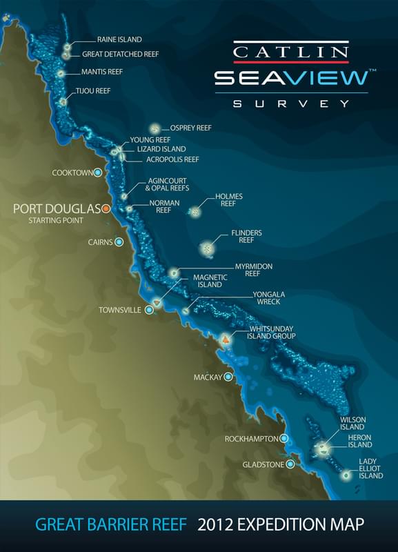
Great Barrier Reef 2012: Expedition map

This map shows the locations for the 2012 XL Catlin Seaview Survey. The expedition only went to a select number of reef systems because it would simply take to long to visit all the individual reefs along the 2,300km length of the Great Barrier Reef. The team chose representative reefs that would give a snapshot of the health of the reef. In addition, the Shallow Survey team are only looking at reefs that lie at a depth of 10m.